Dear Sir/Madame,
Below is the information updated by 30 May 2016 following my visits in August 2011 at the Jewish Cemetery in Berehomet/Siret, Chernivets’Ka Oblast, Ukraine. Alternate names: Berehomet [Ukr], Beregomet [Rus], Berhomete pe Siret [Rom], Berhomet am Sereth [Ger], Berhomet [Yid], Berkhomet-pe-Siret, Berkhomet, Berhometh, Bergomet, Barhumet. Attention: There are also other places with similar names.
The purpose is to assist organizations and persons interested to document and preserve that Jewish cemetery, since my grandmother Sure Sali KATZ née BITTER and her parents Chaim BITTER and Reisel BITTER née SPIEGEL were buried there, and probably also other relatives with the names Izchak KATZ, Bruche RENNERT, Chaim BITTER, Reisl SPIEGEL, SÜSSMANN, ROSNER, ENZENBERG, IVANIER.
Before WW1 Beregomet belonged to Austro-Hungary/Bukowina; after WW1 to Romania/Bucovina, for a year in 1940/41 and after WW2 to the Soviet Union and since 1991 to the Ukraine.
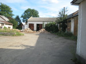
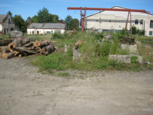
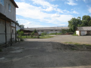
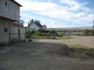
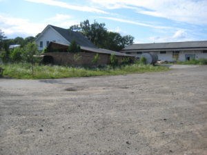
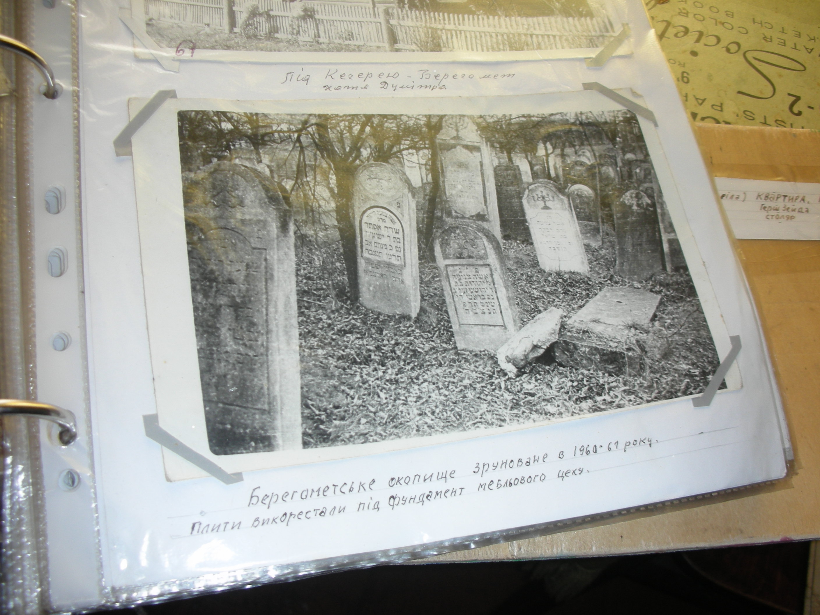
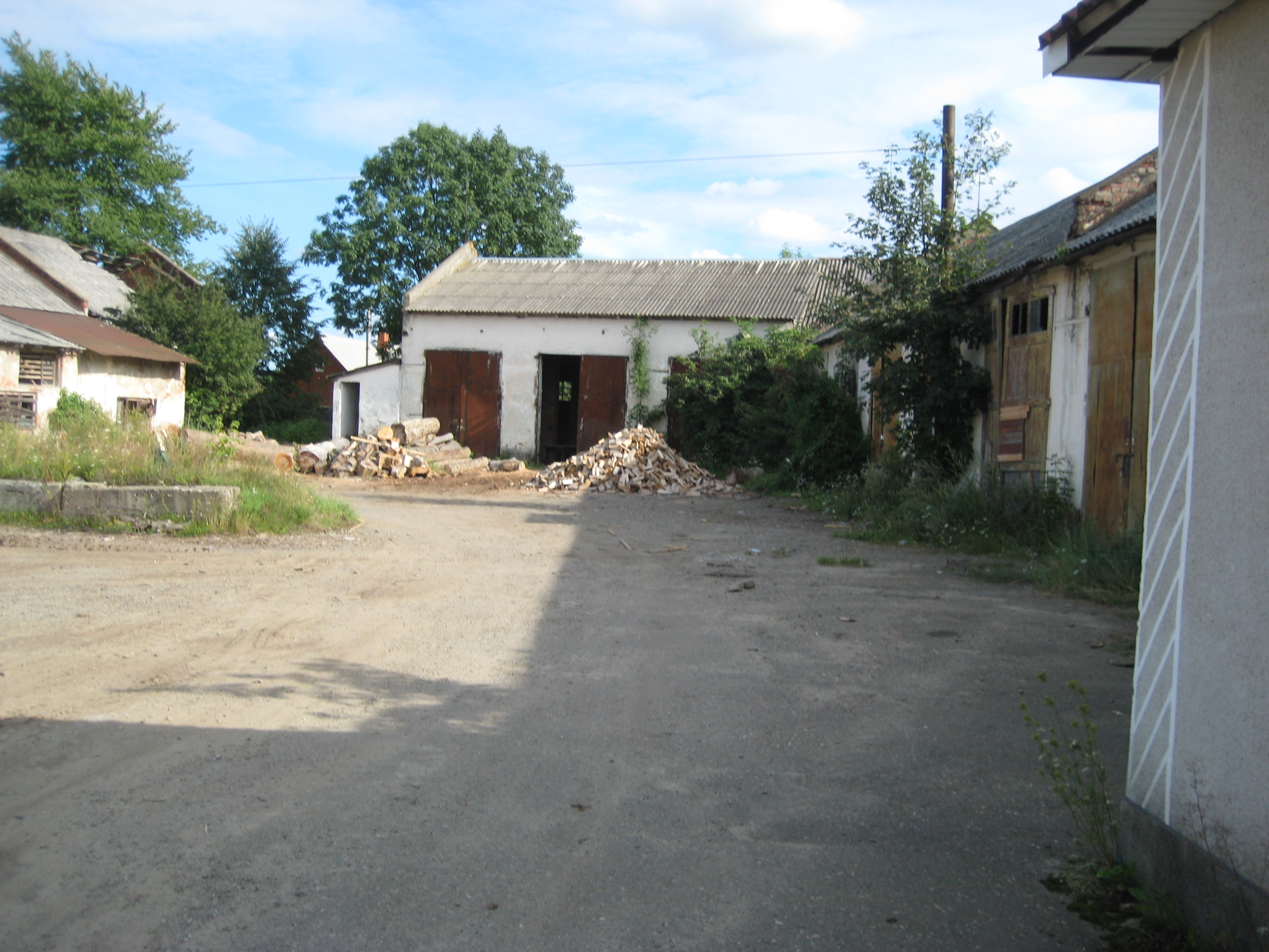
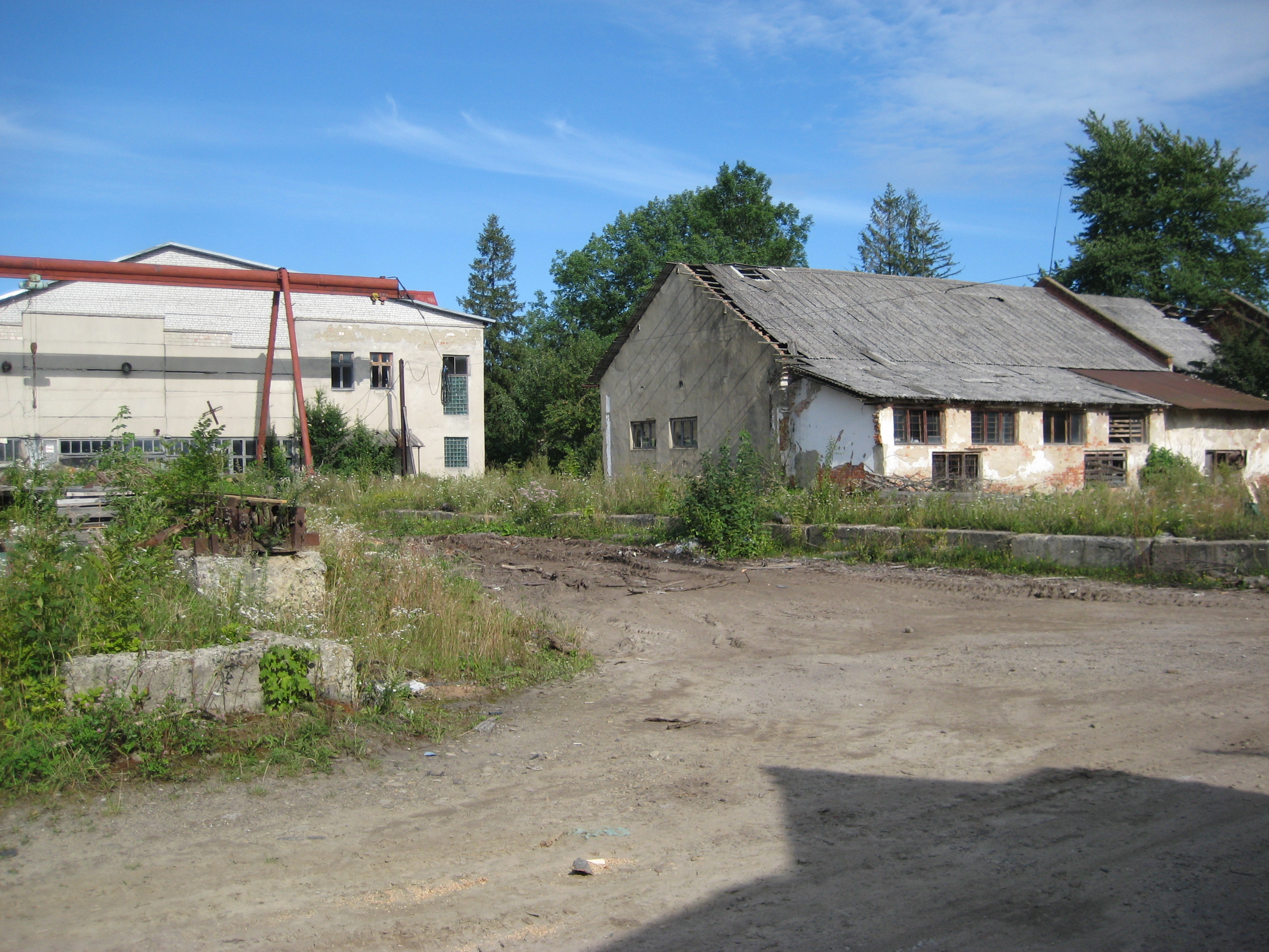
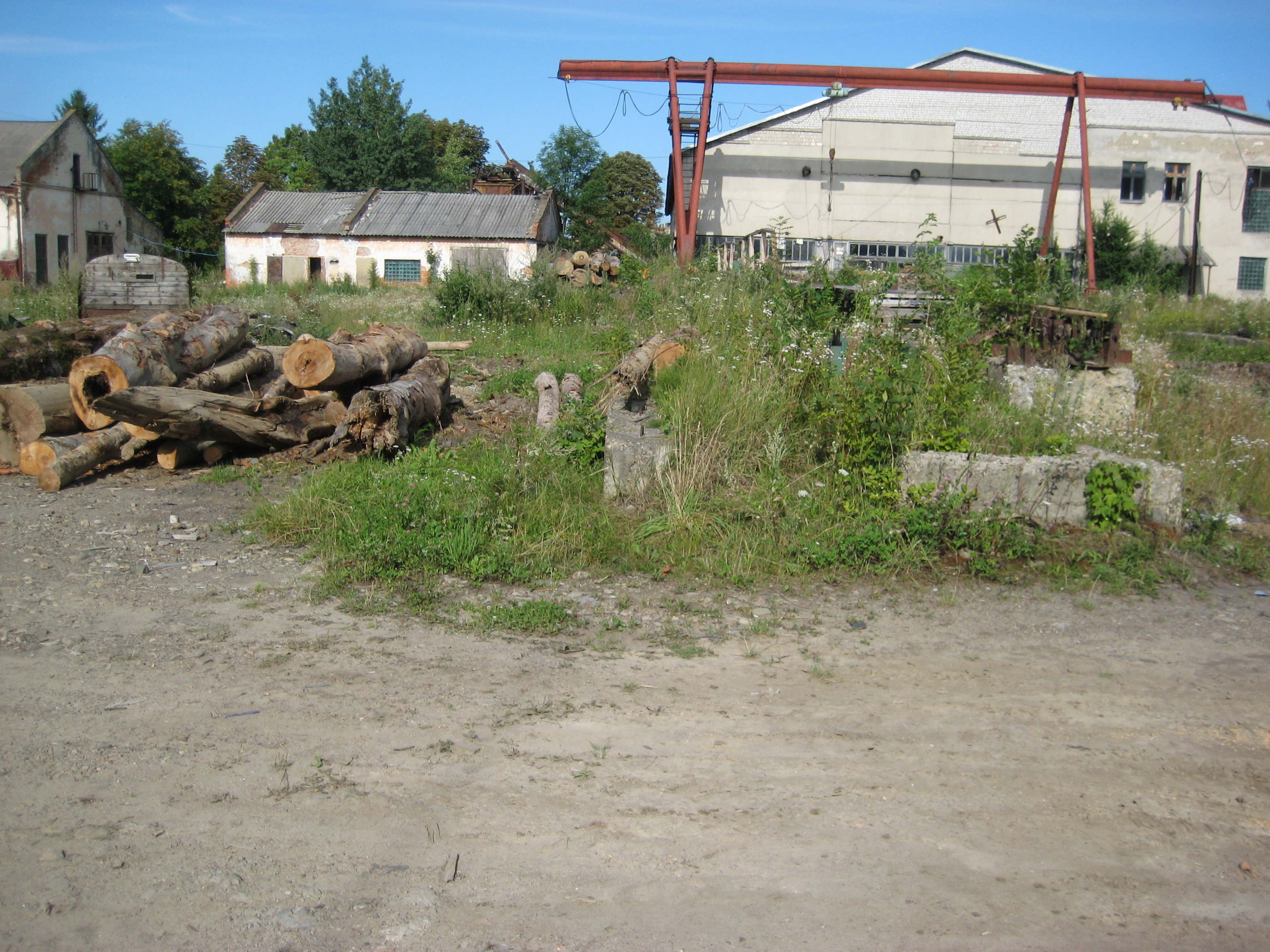
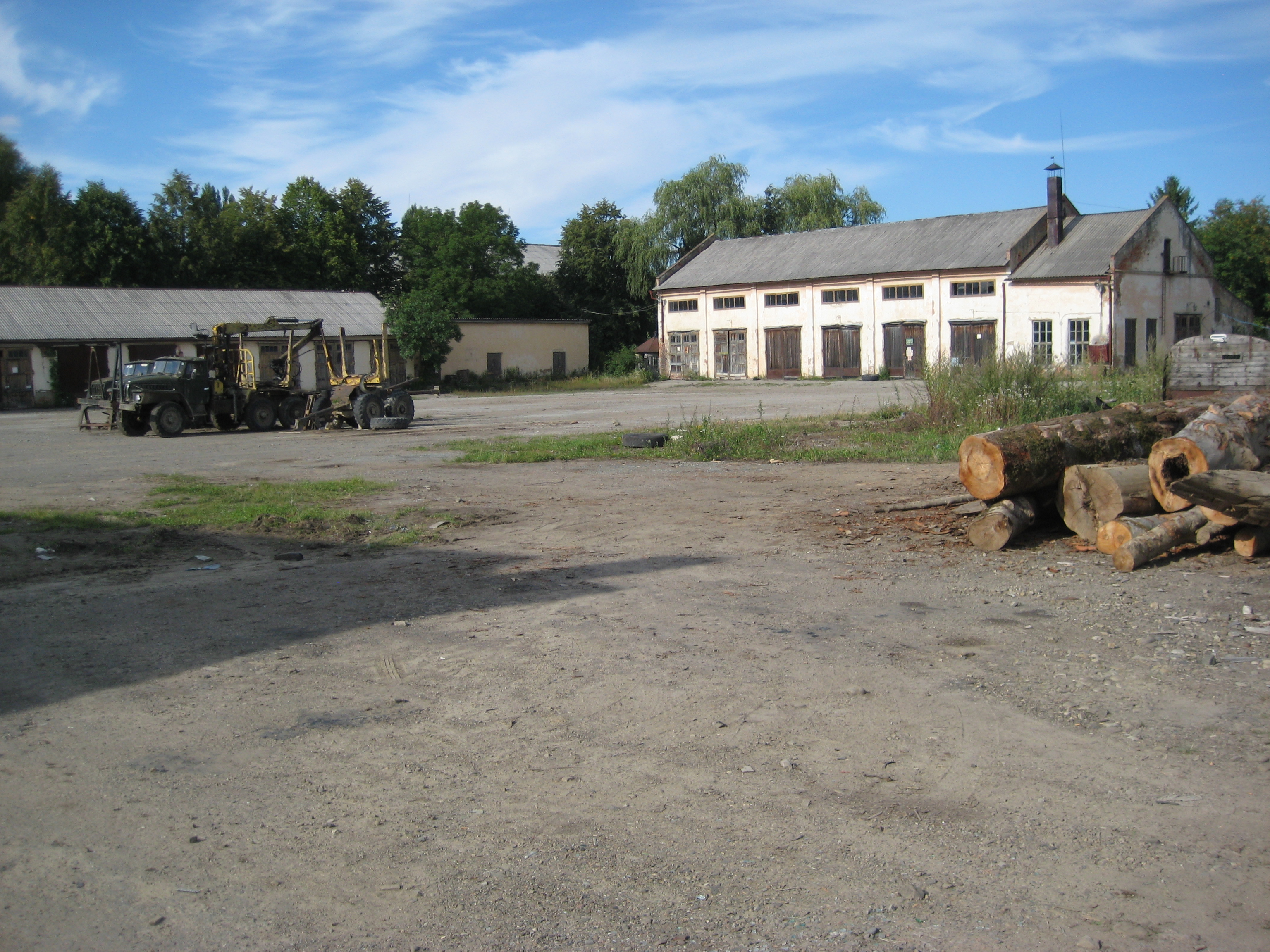
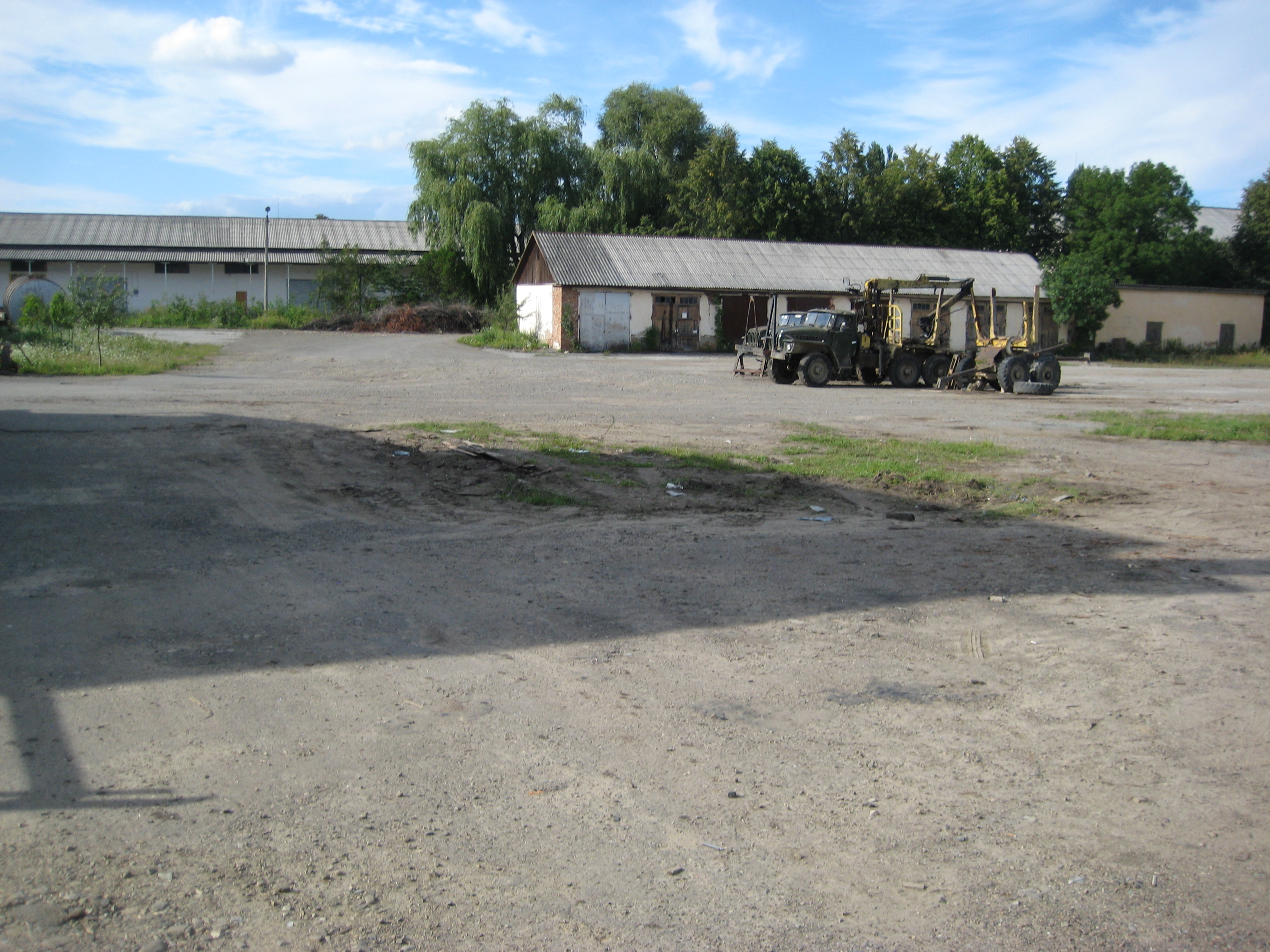
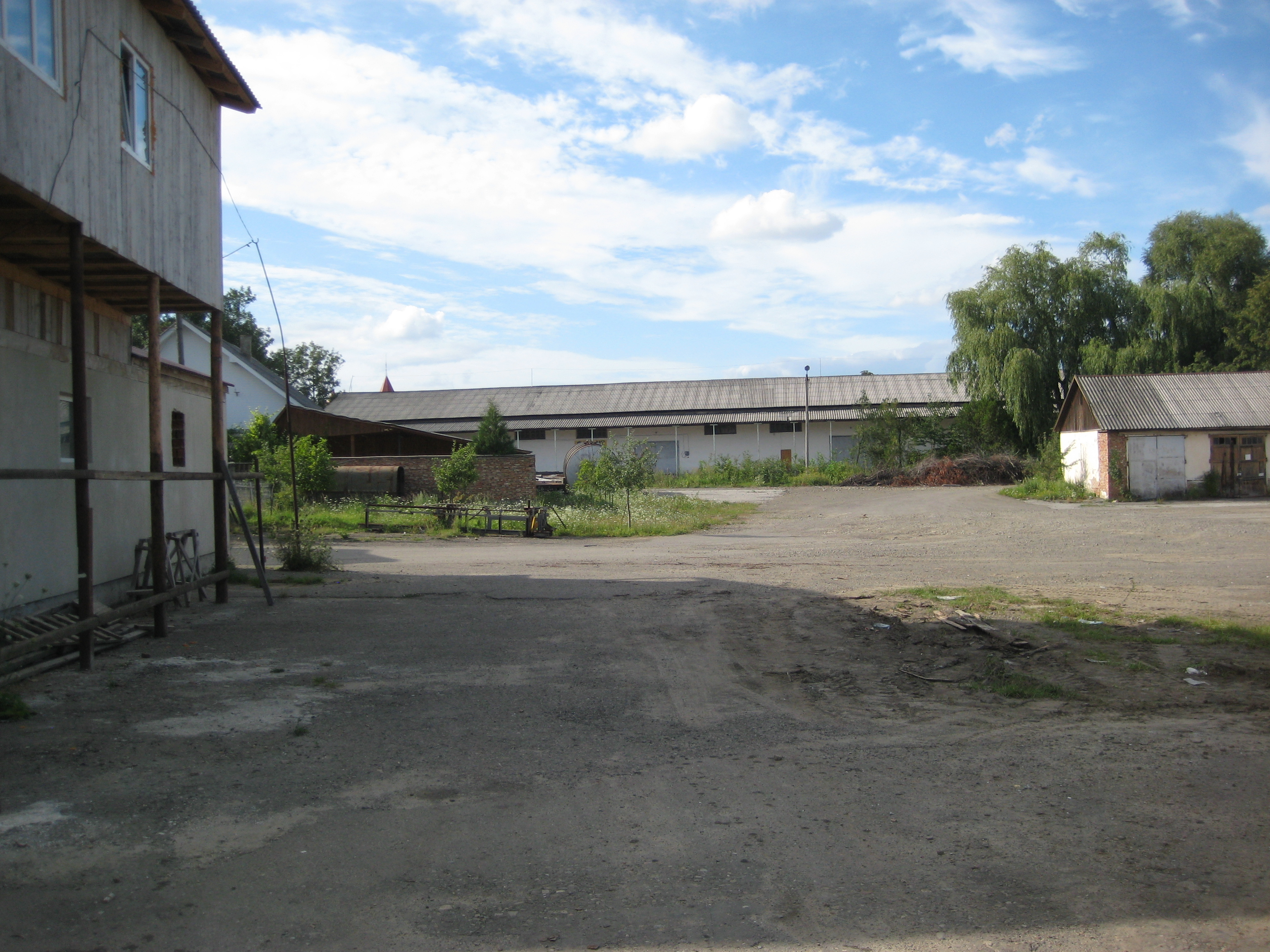
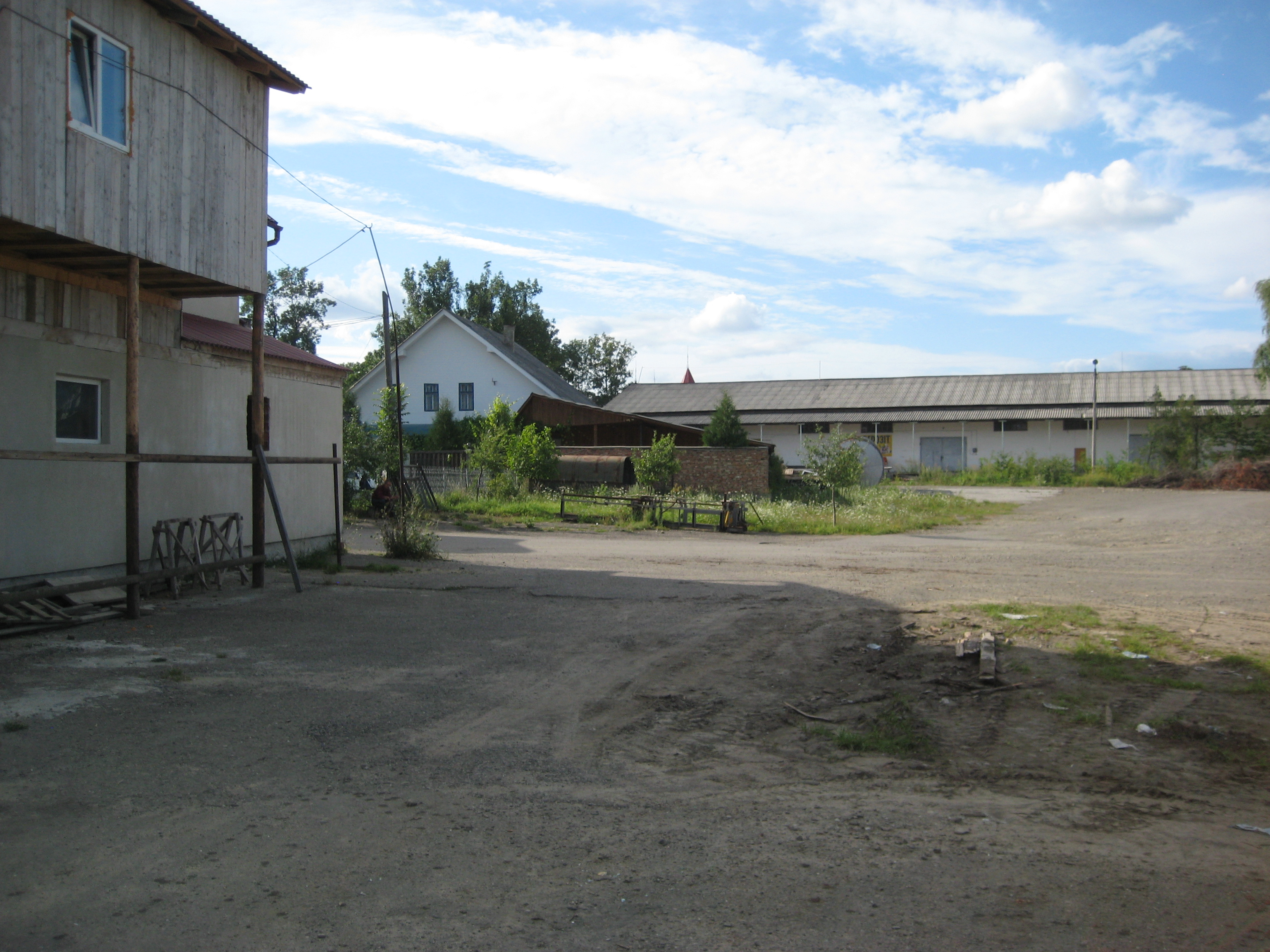
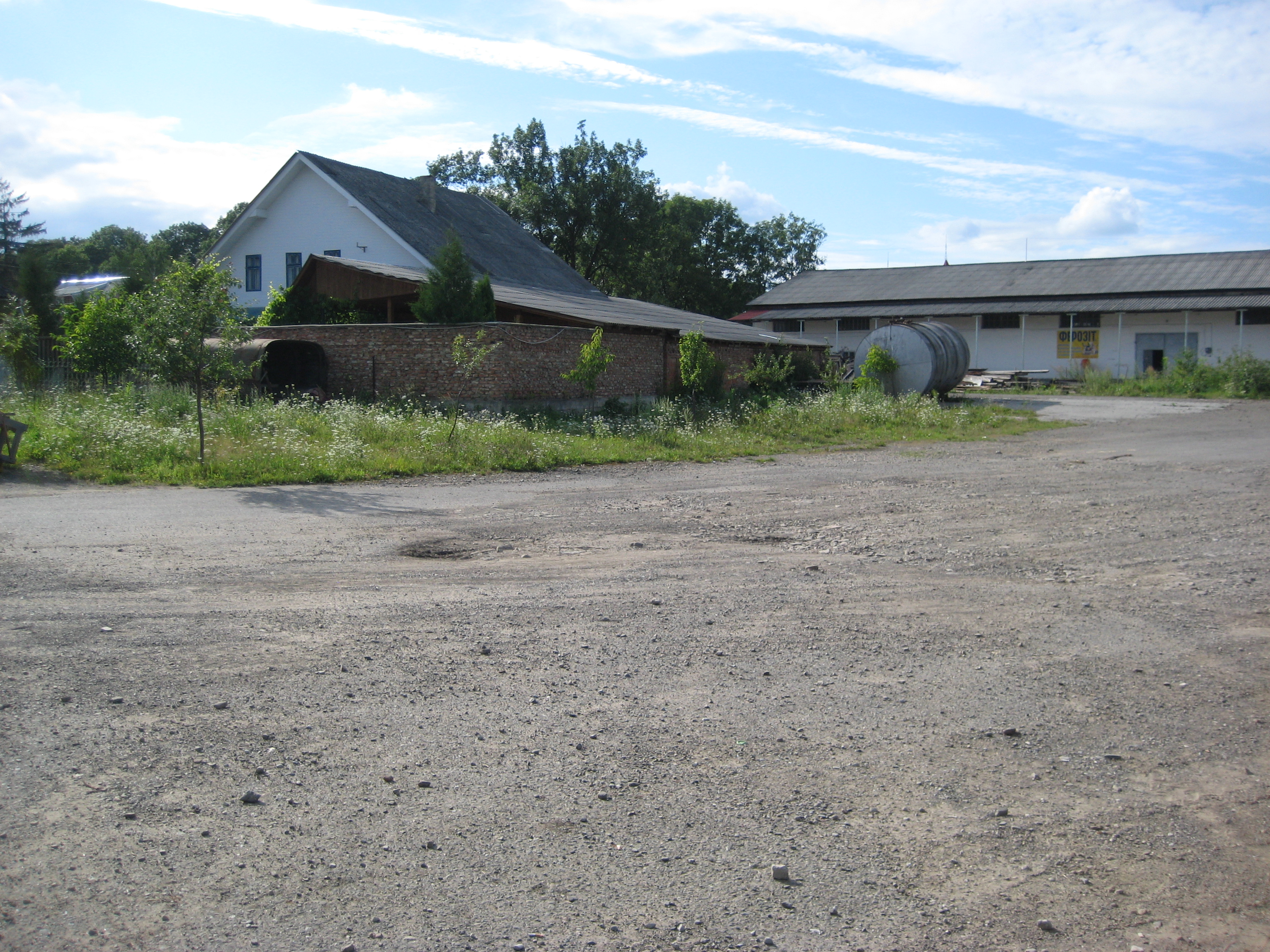
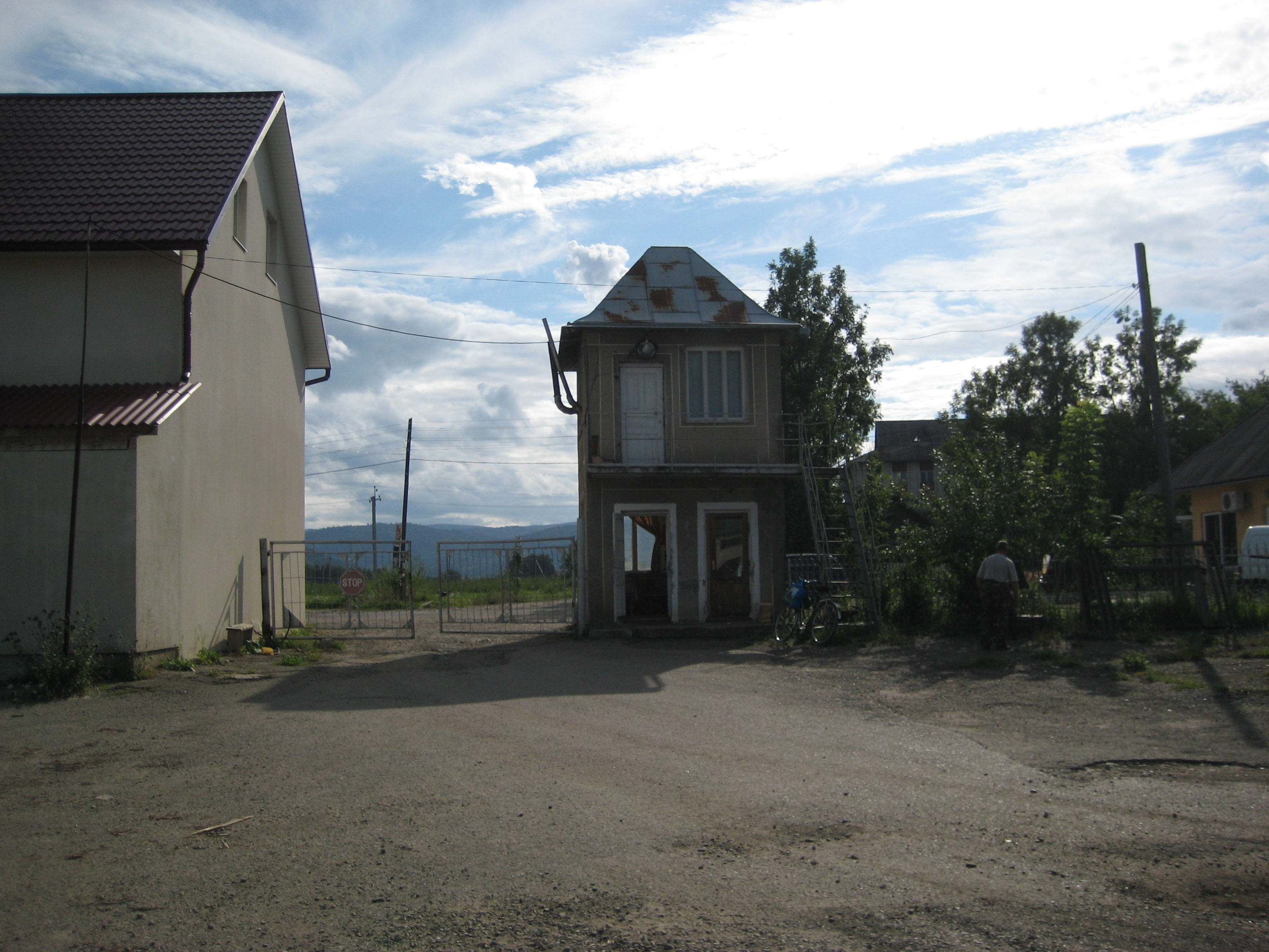
The exact limits of that cemetery in 1941 are not known yet. After WW2 in 1960/1, some buildings (apparently a furniture factory) where constructed on the cemetery. I marked two areas on an air photograph – area1 and area2 (see attached presentation). Area1 is likely to be within the limits of the Jewish cemetery in 1941 and probably until 1960/1, area2 could also have been part of that cemetery. The exact limits can be determined only on basis of Austro-Hungarian maps from before WW1, Romanian maps from before WW2, the local municipality and interviews with old locals.
Apparently in 1960/1 the tombstones were removed from the cemetery. Many and perhaps all tombstones were used for the foundations of the buildings that were built on the cemetery. I was told by locals that the graves are still there under the asphalt pavement, some are however under the new buildings. There are no testimonies about mass graves from the Holocaust.
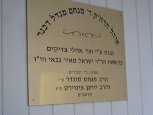
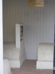
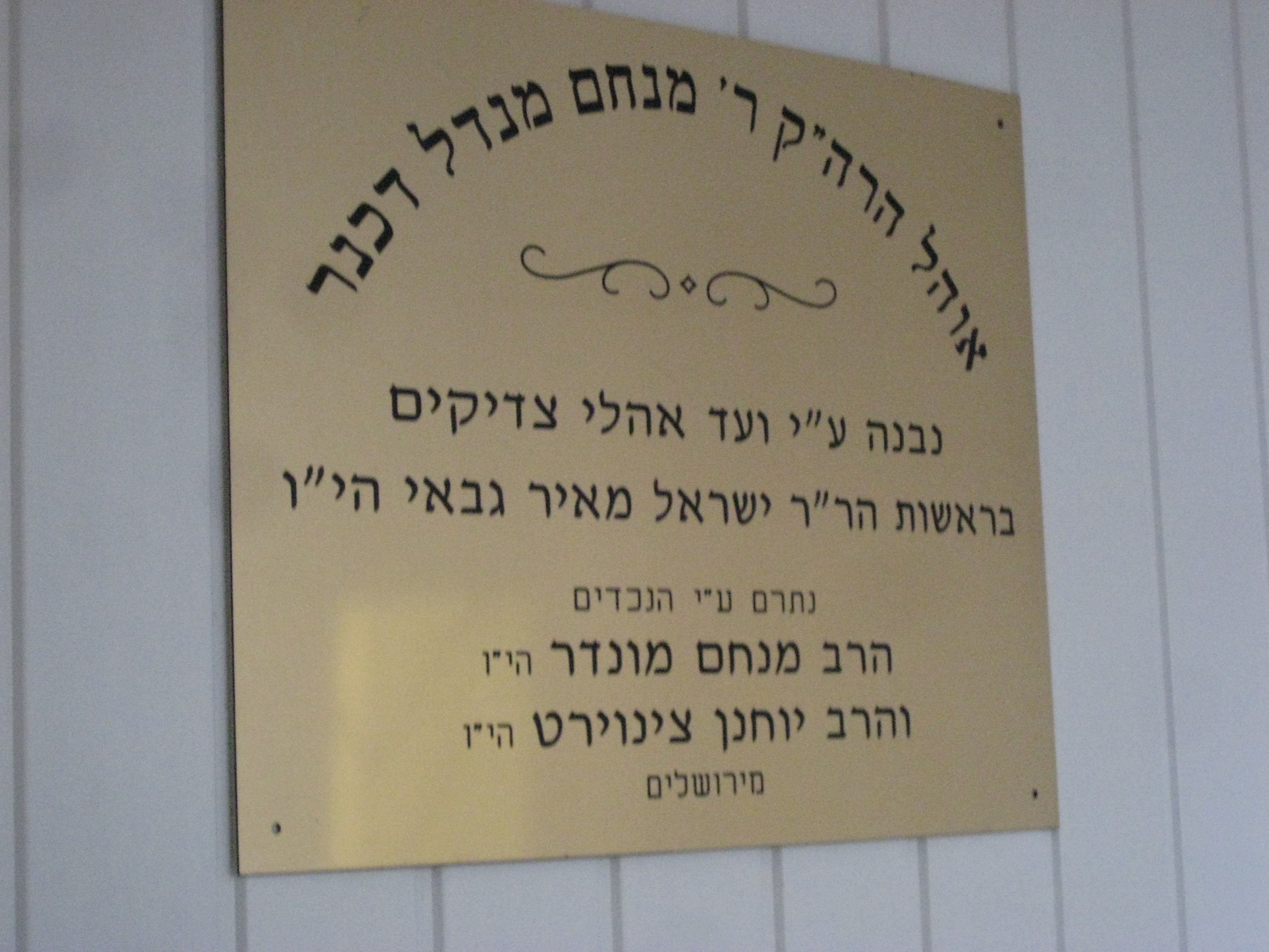
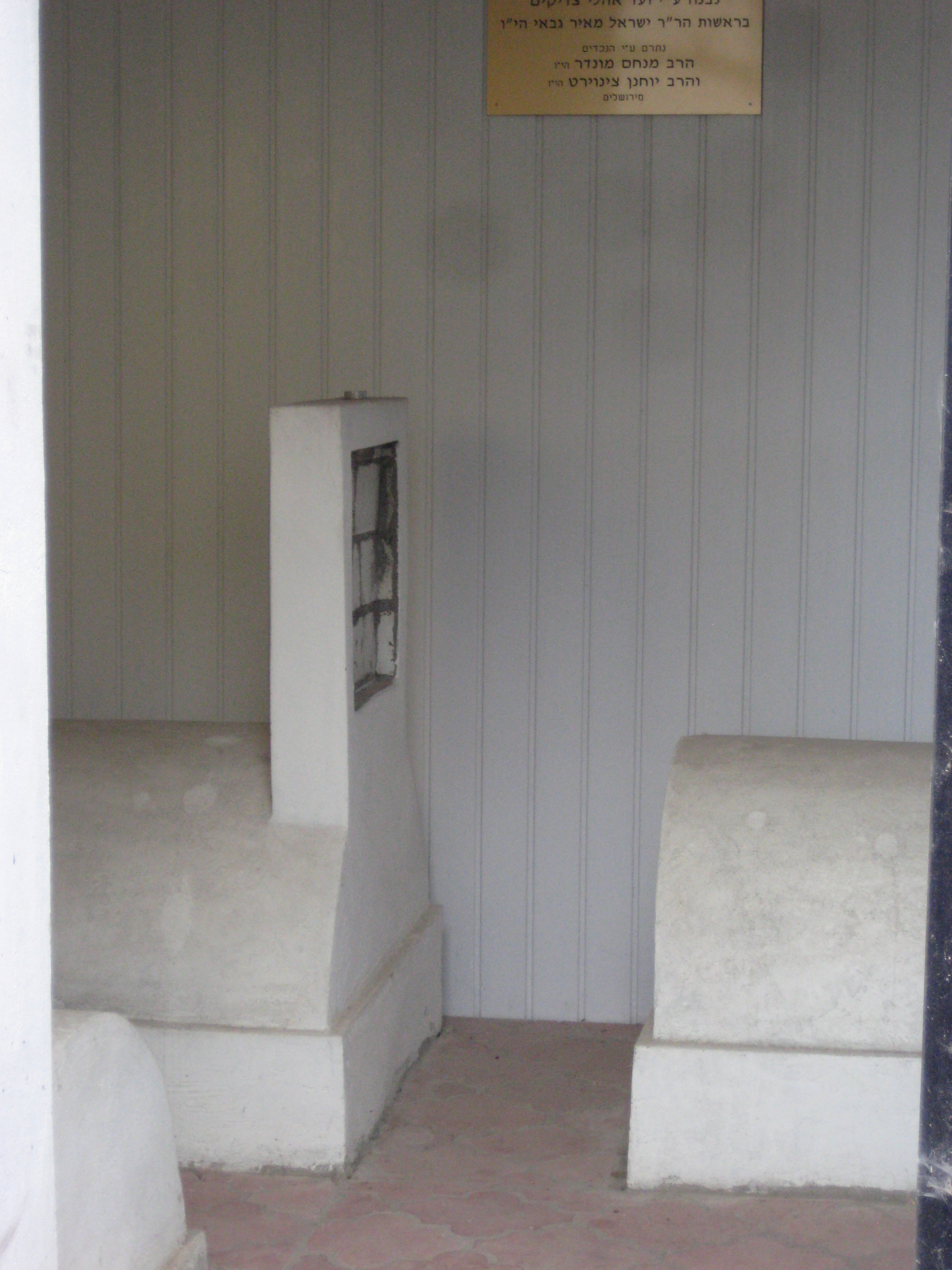
I found 3 new tombstones of the Dachner family in a new building (pictures attached). That work was done by Rabbi Israel Meir GABAY of www.zadikim.org in 2002 on request of the Jochanan ZENWIRTH family from Jerusalem. I met Mr. Gabay on June 3, 2012. Mr. Gabay determined the place of these “Dachner graves” by finding the foundations of a small building that was built once above the graves. He apparently knows how to move things with local authorities.
The most important first next steps are, in my view, to find documents showing the limits of the cemetery in 1941, a plan of the cemetery, who owns this land today and where the tombstones are. All these with the goal to
Please let me know if you can mail me any other information you have and keep me updated with new developments, especially if the Beregomet cemetery is scheduled on any working program for documentation/preservation,.
Yours sincerely,
Daniel Katz
Phone: +972-2-5346454, Skype: d.katz123, WhatsApp +972-54-4679679 Email: katzbymail@gmail.com
Beregomet/Seret Municipality
20 Tsentralna str., Beregomet 59233, Chernivets’Ka Oblast, Ukraine
http://gromady.cv.ua/vn/rada/275/
Tel.: + 380-3730-3-61-68
Fax: +380-3730-3-61-68
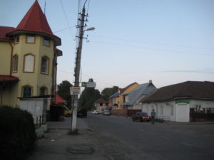
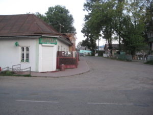
Location of the Jewish Cemetery area in Beregomet:
see attached presentation with pictures from August 2011
Railway Station of Beregomet (very close to the Jewish Cemetery area): http://de.getamap.net/karten/ukraine/ukraine_(general)/_beregomet_stantsiya/
Location of Beregomet on Google Maps:
http://g.co/maps/smmgd
Route from Chernivtsi (Czernowitz) to Beregomet, 55km:
http://goo.gl/maps/E6nwH
JewishGen Locality Page: http://data.jewishgen.org/wconnect/wc.dll?jg~jgsys~community~-1035358
The nearest Jewish communities – Vizhnitsa and Chernivtsi: http://www.jewnet.ru/eng/orgs/?region_id=91&profile_id=0&corp_id=0&action=search
International Jewish Cemetery Project: http://www.iajgsjewishcemeteryproject.org/ukraine/beregomet.html
BEREGOMET:
US Commission No. UA25080101
Alternate names: Beregomet (Yiddish), Berhomet (German), Berhomet pe Prut (Hungarian) and Berkhomet (Polish). Beregomet is located in Chernovitskaya. The town is location at 48º10 25º19, 25 km from Vizhnitsa and 50 km from Chernovtsy. Cemetery: central part of the village on Komsomolskaya St. Present town population is 5,001-25,000 with under 10 Jews.
Town: Village Executive committee of Chairman-Andronik Michail Ivanovich [ph: ya St.20]. : Jewish Culture Foundation of Chernovtsy, Theatralnaya sq.5 [ph: (03722) 21940].
Regional: Soviet narodnih Deputy of Vizhnitsky Region of 275640, Chernovitsky region, Vizhnitsa, Ukrainskaya St.85a [ph: (03730) 21246]. Department of Nationalities of 274010, Chernovtsy, Sovetskaya St.1 [ph: (03722) 22640].
Others: Teacher of Jewish school-Ferdman Efim Nikolayevich [ph: (03722) 22745] Inhabitant of Beregomet-Goldshteyn Leon Kalmanovich of Centralnaya srt.97 [ph: (03722) 36760].
1910 Jewish population (census) was 2000. The last known Hasidic Jewish burial was 1940. No other towns or villages used this unlandmarked cemetery. The isolated, urban, flat land with no sign or marker is reached by turning directly off a public road and Centralnaya St.. Access is open with permission. No wall, fence, or gate surrounds the cemetery. No stones are visible. Location of removed stones is unknown. The cemetery contains no known mass graves. The cemetery property is now used for industrial or commercial use. Adjacent properties are commercial or industrial. Rarely, local residents visit. No vandalism is reported in last ten years. There is no maintenance now. Within the limits of the cemetery is a garage. Very serious threat: weather erosion, vegetation, vandalism, and existing and proposed nearby development.
Hodorkovsky Yuriy Isaakovich of 252037, Ukraine, Kiev, Vozduhoflotsky 37a, 23 [ph: (044) 2769505] visited site on 1/10/95 and interviewed Golshteyn Leon Kalmanovich of Beregomet on 1/27/95. He completed survey on 02/06/1995.
State Archives of Chernivtsi Oblast:
http://www.archives.gov.ua/Eng/Archives/ra25.php
State Archives of Ivano-Frankivsk Oblast: http://www.archives.gov.ua/Eng/Archives/ra09.php
State Archives of Romania in Suceava, Romania:
http://www.arhivelenationale.ro/index.php?lan=0&jud=111
Wikipedia:
English
Romanian
German
Ukrainian
Polish
Old Berhometh Photos:
http://picasaweb.google.com/EdwardTurJ/OldBukowinaPhotosBerhomethSereth
The attached PDF file has explanations and annotated pictures with explanations.
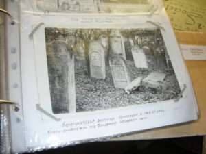
Jewish-Cemetery-in-Berehomet-Seret near Chernivtsi, Ukraine, May 30, 2016

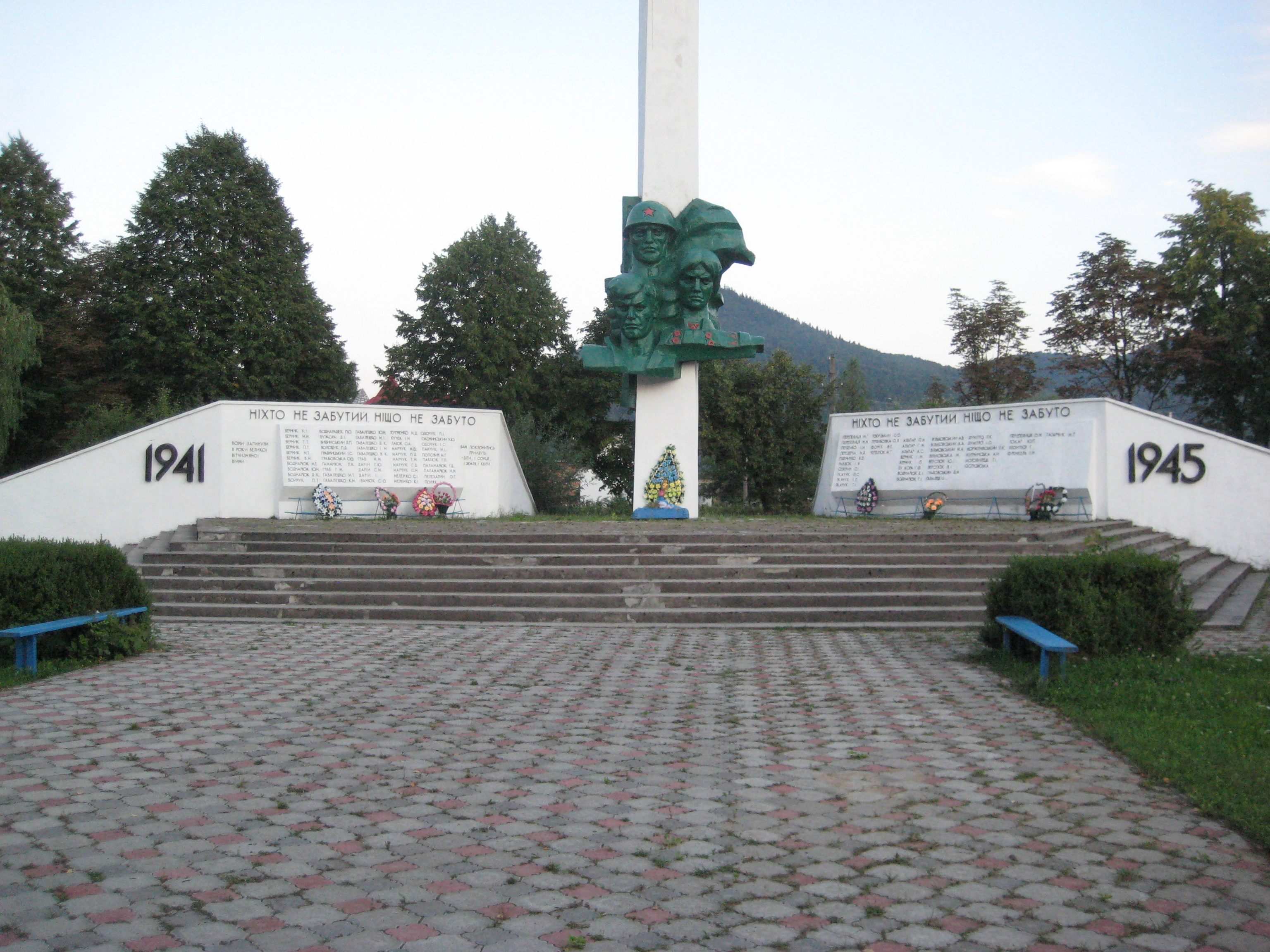
 This is a Soviet-era WW2 monument in Berehomet-Seret, not in the Jewish cemetery area.